<img alt="" src="https://secure.intelligentdatawisdom.com/782514.png" style="display:none;">
Skip to content
Header_Use_Case_Lisiting-1

Collaborate with your Digital Twin

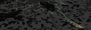
Bring your road data to life with Inspech VISUALISE, the innovative digital twin designed to help you confidently view, share, and align on the condition of your roads.

BrainCreators_icon_white
VISUALISE
 
Full data ownership
Interactive digital tw


Are you interested?
Contact sales.

Would you like to see
a demo first?

Why you need this

  • Accurate, shared view
    Visualise the full condition of your road network, always current, always clear. Great for informed decisions and smooth communication with stakeholders.
  • Built for collaboration
    Keep everyone on the same page. Share a single source of truth that’s easy to update and easy to understand.
  • Safer, smarter workflows
    Access and manage inspections remotely, so your team spends less time in the field and more time staying safe and productive.
  • Flexible and future-proof
    Your data, your way. Update and adjust your digital twin whenever you need, with total control over your visual insights.
Screenshot 2024-09-26 172828

What's in store

  • Visual Data Import
    Easily upload geo-tagged images or GoPro footage, and see it all plotted on an interactive map.
  • Section Files
    Add your own section shapefile, or create one directly in Inspech.
  • Inspection Overview
    Get a high-level summary of your network’s condition at a glance.
  • Exportable Reports
    Quickly share insights with exports in XLS or SHP formats.
  • Distress Mapping
    Pinpoint and measure damage on the map, with full detail and context.
  • Condition Grades
    Understand road health instantly with global and local standards.
Screenshot 2