
PLATFORM OVERVIEW
A professional visual road-assessment workflow, supported by AI.
Inspech combines compatible road imagery, a georeferenced inspection environment, AI-assisted recommendations and inspector validation.
The result is structured, traceable visual condition information that can be compared, reported and exported.
| AI accelerates the review. Inspectors own the assessment
COMPATIBLE INPUTS
Start with road imagery that fits the inspection objective.
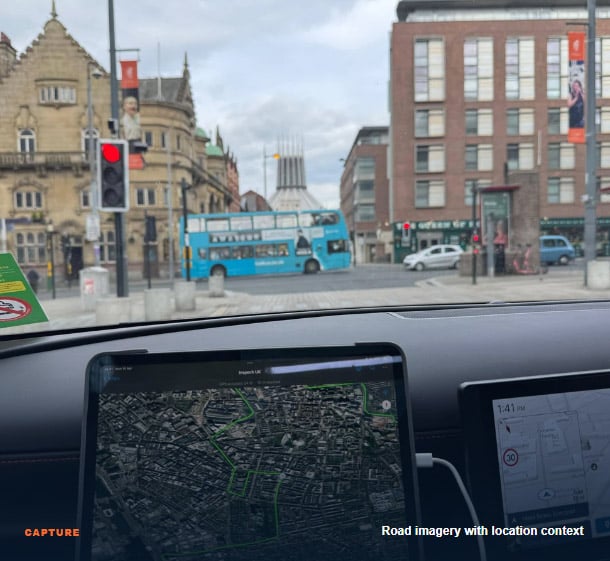
Inspech works with compatible road imagery from accessible camera configurations and validated professional capture workflows. The route, image quality, positioning and required inspection method are confirmed before operational use. Imagery is organised geographically so inspectors can review individual findings without losing the wider road-section context.
Compatibility is validated, not assumed.
Capture quality and location information must support the intended visual assessment.
THE INSPECTION ENVIRONMENT
See the network, the road section and the evidence together.
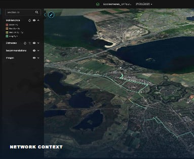
Instead of reviewing disconnected video fragments, teams work in one georeferenced environment that preserves route structure, imagery and assessment context.
01
Georeferenced digital environment
Navigate routes and road sections while preserving the relationship between imagery, location and inspection findings.
02
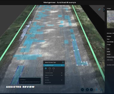
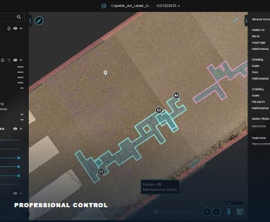
Potential defects in context
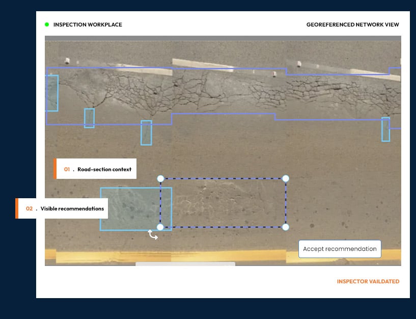
AI highlights visible patterns and suggests classifications for an inspector to review.
03
Review and validation
Inspectors confirm, adjust or reject every recommendation and remain responsible for the final assessment.
HOW THE PLATFORM WORKS
From compatible imagery to inspector-validated results.
A six-step visual assessment workflow designed to strengthen professional practice, not replace established methods, measurements or responsibility.
01
Plan and capture
Define the road section, applicable method and validated capture configuration. Record compatible road imagery while preserving location information.
02
Ingest and organise
Upload imagery into a georeferenced inspection environment with route, road-section and image context.
03
Receive recommendations
Inspech highlights potential visible surface defects and suggests classifications for professional review.
04
Review and validate
Inspectors confirm, adjust or reject recommendations using expertise, context and the applicable assessment method.
05
Compare change
Where repeated cycles exist, compare validated imagery and observations to understand visible change over time.
06
Report and export
Use structured results and supported outputs in reporting, GIS and road-management workflows.
WORKFLOW PRINCIPLE | AI accelerates the review. Inspectors own the assessment. Engineers and asset managers own the decisions that follow.
RESPONSIBLE AI IN PRACTICE
Clear roles. Visible recommendations. Professional control.
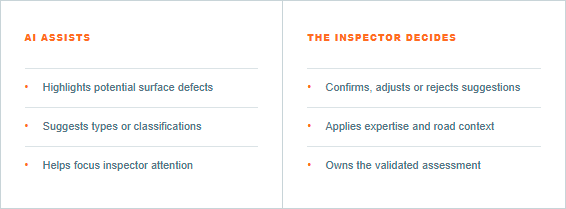
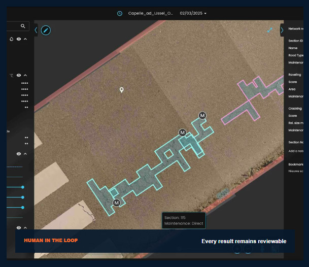
Inspech uses AI where it can reduce repetitive review and support consistency. Recommendations remain visible and reviewable; they are not treated as final assessments.
ACROSS RECURRING CYCLES
Preserve a growing history of visible network change.
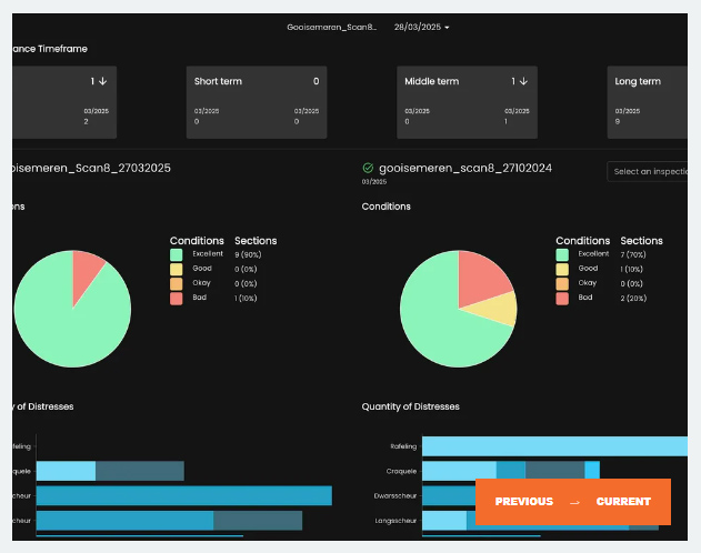
An individual inspection records what was visible at one moment. Where repeated cycles exist, Inspech preserves georeferenced imagery, validated findings and inspection context so teams can compare condition over time. Each validated cycle adds context to the current network view and supports more informed professional attention, planning and reporting.
Recurring inspections → Validated history → Network context.
OUTPUTS AND SYSTEM FIT
Structured visual evidence for the workflows around Inspech.
Review results in the platform and use supported reports, geodata and exchange routes without positioning Inspech as a replacement for engineering measurements or management systems.
Designed to complement
LCMS · IRI · FWD · Skid resistance · Pavement engineering · GIS · PMS · AMS
ONE PLATFORM, CLEAR RESPONSIBILITIES
Useful at every level of the inspection workflow.
Each role receives more structured and current visual evidence while professional ownership remains explicit.
01
Inspectors
Reduce repetitive review work, preserve road context and retain control of every assessment.
02
Pavement engineers
Use current visual evidence to focus investigation and support professional interpretation.
03
Asset managers
Maintain a more current, traceable view between formal surveys for planning and reporting.
04
Management
Support consistent delivery, governance and defensible accountability across the organisation.
PLATFORM EVIDENCE ACROSS OPERATING CONTEXTS
ROAD CONCESSIONAIRE
A-Lanes A15
Consistent contractual inspection within a 37 km DBFM project environment.
ENGINEERING PROVIDER
Unihorn
Assisted visual assessment as step two in a wider professional pavement investigation.
ROAD AUTHORITY
Rijkswaterstaat · Unihorn
Approximately 80% of the Dutch national highway network already inspected within a professional delivery workflow.
OPERATIONAL VALIDATION
See how the platform fits your inspection workflow.
Use a representative route, compatible imagery, your applicable inspection method and your own professional inspectors to evaluate workflow fit, effort, consistency and outputs.
EVALUATE THE COMPLETE WORKFLOW
✓ Imagery and capture compatibility
✓ Georeferenced inspection setup
✓ Recommendations and inspector validation
✓ Standards, reporting and outputs
✓ Potential recurring inspection cadence