Skip to content
hero_concessionaires

Road Inspection Software for Road Concessionaires.


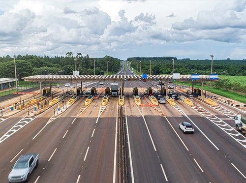
Keep a more current view of pavement conditions to plan timely maintenance, manage costs and support reporting to authorities. Inspech complements your existing survey programme with digital visual inspections, giving your team validated findings and road imagery to inform maintenance priorities and substantiate reported conditions.

Keep track of conditions
between surveys


Give your maintenance team more current information to work with between scheduled engineering surveys. More efficient visual inspections make it practical to review developing defects and identify locations that need closer attention before the next measurement campaign.

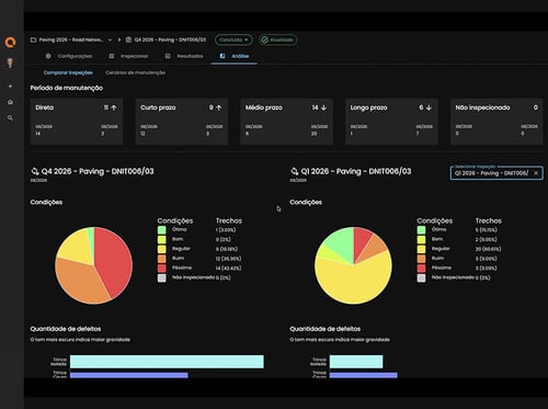
Inspech helps you compare recent findings with previous inspections, so your team can reassess priorities as visible conditions change. This supports timely follow-up and maintenance planning alongside the structural and functional measurements in your existing programme.

Road Concessionaires Tolroad

Plan timely interventions
and manage maintenance costs


Intervening while targeted repairs are still appropriate can help preserve pavement life and avoid more extensive rehabilitation later. For concessionaires, the timing of those decisions affects maintenance expenditure and the financial performance of the concession.

More current inspection findings help your engineers identify developing defects and assess where earlier action could offer better value than deferring work. Combined with engineering measurements and cost analysis, this evidence supports maintenance choices that help control expenditure over the concession term.

comparison-1

Support reporting to authorities with clear evidence

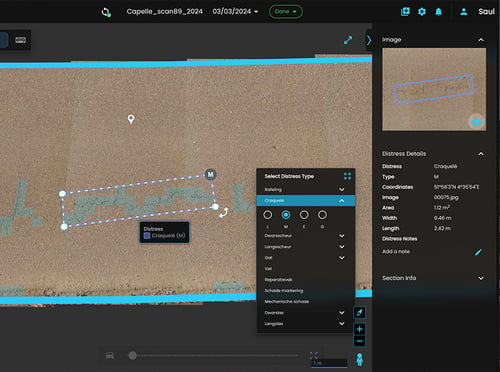
Substantiate reported pavement conditions with validated findings, road imagery and inspection history. A structured inspection record helps your team explain assessments and respond to questions from the granting authority or regulator.

Inspech makes the evidence behind your reports easier to review and share. Your team can refer back to specific locations and inspection dates, compare findings over time and prepare the visual condition information required for reporting under the applicable concession requirements.

Road Concessionaires Evidence

Coordinate maintenance
teams and inspection partners


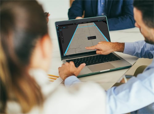
Help your teams and inspection partners agree on which locations need attention and what should happen next. Shared findings and road imagery give discussions a concrete basis, making it easier to clarify assessments, request further investigation and align maintenance priorities.

Authorised colleagues and partners can review the relevant results in Inspech, with access governed by their roles and permissions. This reduces the effort of assembling separate reports and images for each discussion, helping teams move from inspection findings to coordinated follow-up.

collaboration-1

See Inspech in practice


Dutch national highways: Monitoring change across inspection cycles


See how Unihorn uses recurring inspections on Rijkswaterstaat-managed roads to follow changes in visible pavement condition and support maintenance prioritisation.

Read the client success story →

DTAP: Delivering inspections at scale


See how DTAP incorporated Inspech into its pavement-assessment workflow and delivered more than 10,000 lane-km across client assignments in its first year of operational use.

Read the client success story →

See how Inspech supports your concession

Explore how more current inspection information can help you plan timely maintenance, manage costs and support reporting to authorities. In a live demo, we’ll show you how Inspech fits alongside your existing survey programme and supports your team’s priorities.
new-behaviour

Frequently asked questions

How does Inspech complement periodic LCMS, IRI and FWD surveys?

Inspech provides recurring visual pavement assessments that complement established measurement programmes. While LCMS, IRI and FWD contribute specific surface or structural measurements, Inspech helps inspection teams document visible defects and review changing conditions between survey campaigns. Engineers can use these findings alongside existing measurements to determine where additional investigation or maintenance attention may be needed.

Can we inspect specific high-priority sections instead of the entire concession network?

Yes. Inspech supports inspections of selected roads and road sections, allowing concessionaires to focus their visual assessments on areas relevant to their maintenance priorities. This can be useful for monitoring developing defects, reviewing locations identified during previous surveys or documenting conditions after maintenance work.

Can Inspech help demonstrate compliance with concession reporting requirements?

Inspech can provide structured, inspector-validated findings, dated road imagery and inspection history to support reporting to granting authorities or regulators. This makes it easier to substantiate reported visible pavement conditions with supporting evidence. Whether these outputs satisfy particular contractual or regulatory requirements depends on the applicable concession agreement, methodology and reporting specifications.

Can we compare pavement conditions before and after maintenance interventions?

Yes. Inspech allows teams to review findings and imagery from different inspection cycles to examine changes in visible pavement condition. Concessionaires can use this information to document the condition of treated sections and identify subsequent deterioration. These comparisons support maintenance follow-up, while more comprehensive performance assessments may require additional engineering measurements.

How can concessionaires coordinate inspection findings across different teams and contractors?

Inspech enables authorised users to work with shared inspection information through role-based and inspection-specific access permissions. Maintenance teams, engineering specialists and inspection partners can refer to the same validated findings, locations and road imagery when discussing priorities or follow-up investigations. This supports coordination while maintaining appropriate control over inspection data and editing rights.